One platform. Three layers.
No blind spots.
AIRMO monitors methane from the ground to orbit. Each layer works independently or together — matched to your asset size, geography, and compliance requirements.
LDAR
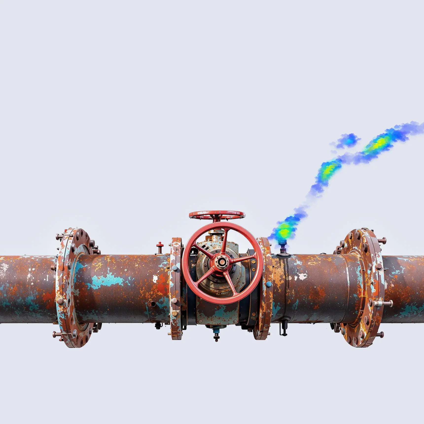
Fix methane leaks fast. Timely. Accurate. Compliant. AIRMO’s methane leak detection and repair (LDAR) service equips energy companies with high-precision data to detect, quantify, and respond to methane emissions — before they escalate into costly liabilities.
What we monitor
Valves and flanges
Compressors and seals
Storage tanks and hatches
Pipelines and gathering lines
Pneumatic controllers and pumps
Wellheads and processing units
How it works
01
We prepare a master list of equipment and conduct a detailed field survey. Every potential leak source is tagged and mapped. At this stage, we also identify all emissions that can be minimised at the facility level to set a clear baseline.
02
Using AIRMO TDLAS sensor, we identify leaks, categorise them by type, and assess severity. Required repairs are logged and prioritised, laying the groundwork for effective mitigation and regulatory compliance.
03
We install or help you develop an in-house software solution tailored to your site. All tagged components are digitised and integrated into a searchable database, enabling streamlined tracking, inspections, and automated reporting.
04
We design a custom LDAR training programme for your field teams, ensuring they can confidently carry out inspections and repairs to the required standard.
For pipelines, AIRMO’s TDLAS drone sensor operates standalone — flying the route, detecting emissions, and attributing them to source. For more complex infrastructure — compressor stations, storage sites, processing plants — the drone combines with handheld sniffers and OGI cameras to pinpoint individual components down to valve level.
Compliance coverage
EU Methane Regulation 2024/1787 — Type 1 and Type 2 LDAR survey requirements
Facility type
Required frequency
Compressor station, Underground storage, LNG facility, Regulating/metering station
Every 4 months
Valve station
Every 9 months
Facility type
Required frequency
Compressor station, Underground storage, LNG facility, Regulating/metering station
Every 8 months
Valve station
Every 18 months
OGMP 2.0 Level 4 — source-level measurement replacing emission factor estimates
Full audit trail for regulator and third-party review
Deliverables
Geo-referenced source list: every leak located, measured in kg/h, uncertainty-bounded
Prioritised repair list ordered by emission rate and estimated loss value
Auto-generated reports aligned with EU Methane Regulation standards
Full audit trail of inspections, repairs, and follow-up
Simple integration with your internal reporting workflows
OGMP 2.0
OGMP 2.0 Gold Standard: Achieved. AIRMO’s site assessment service delivers precision methane data packed in actionable reports — from source-level quantification to full site reconciliation. Stakes are high. We help you get there.

What we cover
Source-level quantification (Level 4) — fugitives, pneumatics, tanks, compressors, flares, vents, intermittent events
Site-level reconciliation (Level 5) — full-facility flux measurement and top-down/bottom-up alignment
All asset types: upstream production, midstream pipelines, compressor stations, gas storage, LNG, processing plants
Operated and non-operated assets across single and multi-site portfolios
How it works
01
Document review. We analyse facility documents provided by the operator, including P&IDs, process descriptions, previous Level 4 reports, and equipment datasheets.
02
Flight planning. Monitoring plans are optimised for site layout and local weather (wind, temperature) to maximise data quality and spatial coverage.
03
Systematic UAV surveys. We collect high-resolution methane concentration data across the site using autonomous flight paths.
04
Data fusion. GPS and IMU data are overlaid to georeference measurements and correct for movement.
05
Leak quantification. Emissions are quantified using AIRMO’s proprietary algorithm.
06
Reconciliation with Level 4. We compare site-level results with existing component-level (OGMP Level 4) data. If discrepancies exceed OGMP thresholds, we trigger targeted re-measurements to reconcile.
07
Targeted ground validation. At critical units or where emissions are expected, OGI provides visual leak confirmation. FID is used for cross-validation and for detecting diffuse or low-intensity emissions.
Compliance timeline
Deadline
Requirement
February 5, 2026
Submit first quantified source-level emission reports (OGMP Level 4) for operated assets
February 5, 2027
Submit Level 4 for non-operated assets · Submit first site-level reports (Level 5) for operated assets
August 5, 2028
Submit Level 5 for non-operated assets
Deadline
Requirement
January 1, 2027
MRV programmes must be equivalent to OGMP Level 5
August 5, 2028
Report methane intensity of production
August 5, 2030
Introduce methane intensity cap
Deliverables
OGMP 2.0 Level 4 source inventory with measurement-based emission factors per source category
Level 5 site-level flux measurements with full uncertainty quantification
Reconciliation report per OGMP 2.0 framework specifications
UNEP submission-ready templates, pre-populated
Full audit trail for regulator and third-party review
Global Insights
See exactly which asset is emitting, how much, and with what certainty. Continuous methane intelligence across your entire asset base — from public satellite feeds today, upgraded to AIRMO’s own active LiDAR satellite from Q1 2027. Real-time alerts, asset benchmarking, and automated reports in one dashboard.
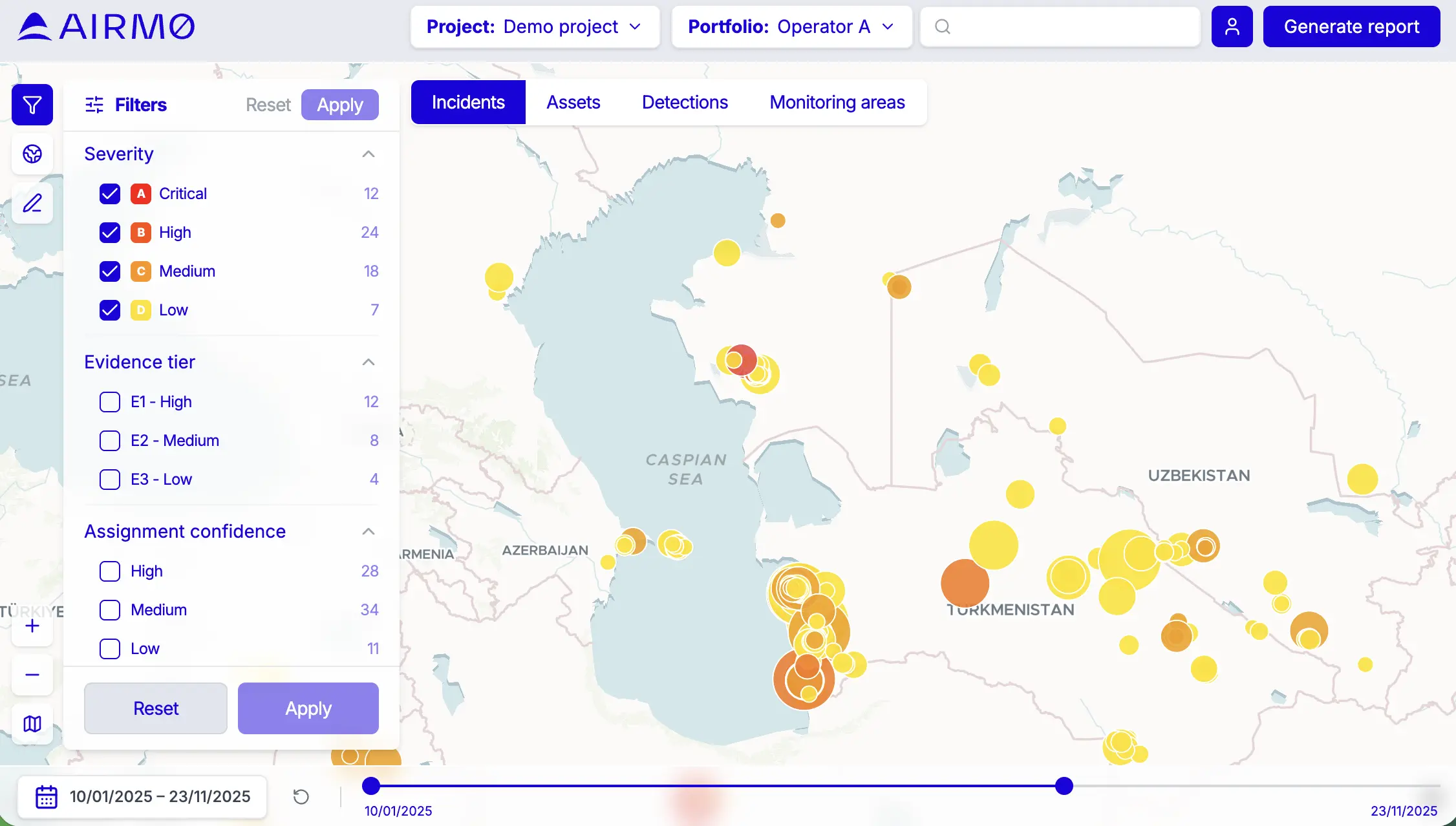
What it tracks
Super-emitters and facility-level emission events across your asset portfolio
Methane intensity benchmarks by asset, company, and region
Financed emissions across whole portfolio with equity attribution
Regulatory compliance status supporting OGMP 2.0 and EU Methane Regulation
100+ major O&G companies globally — no blind spots
How it works
01
Data ingestion. The platform continuously ingests public satellite feeds — Copernicus, NASA, GOSAT, and other proprietary missions, alongside AIRMO’s own survey data. From Q1 2027, AIRMO’s proprietary high-sensitivity satellite measurements.
02
Attribution. Our algorithms attribute detected methane enhancements to specific facilities, operators, and shareholders using georeferenced asset databases.
03
Quantification. Every detected event is quantified in kg/h, giving you direct financial and regulatory exposure.
04
Reporting. Super-emitters analytics on asset level, delivered as monthly customised reports.
AIRMO satellite — Q1 2027
When AIRMO’s own satellite launches, Global Insights upgrades from public data to proprietary LiDAR + SWIR fusion measurements. Active sensing operates in dust, cloud, and low-light conditions where all passive satellites fail. 50 kg/h detection threshold, 20km swath, weekly revisit per satellite , daily with the full constellation.
Compliance coverage
OGMP 2.0 — support top-down verification layer for Level 5 reconciliation
EU Methane Regulation 2024/1787 — asset level importers KPIs verification
SFDR / CSRD / EU Taxonomy/EBA ESG Disclosures & Risk Management — MRV for financial institutions
Deliverables
Continuous emission monitoring reports with asset-level drill-down
OGMP 2.0 and EU Regulation reporting templates auto-populated
How they connect
LDAR
Finds the leaks and gets them fixed.
OGMP 2.0
Proves you measured everything properly, to the standard regulators and investors require.
Global Insights
Insights gives you continuous visibility across your whole portfolio — so the next leak doesn’t wait for the next inspection.